RS-01HENOCK SEIFE

Lab / DossierRF · Space · Embedded · 2026

PRJ·01 Satellite ground station and hydrogen-line receiver

Receive live weather-satellite imagery, and detect the Milky Way's hydrogen, with a home-built software-defined radio station.

System diagram

Signal path: the 1.4 metre dish feeds a Nooelec GOES low-noise amplifier, then an RTL-SDR receiver, then a Raspberry Pi 5. Python processes the I/Q samples with an FFT, demodulates and decodes them. Tuned to the L-band downlink, the chain produces GOES-18 imagery; retuned to 1420.4 MHz, it produces a hydrogen-line spectrum.

Objective

Geostationary weather satellites broadcast imagery continuously, but receiving it takes a carefully built RF chain. I wanted to build that chain myself and understand every stage, from the dish to the decoded image.

Build log

  • Assembled the receive chain and tuned the sample rate and gain.
  • Fixed a high noise floor by relocating the station away from local interference.
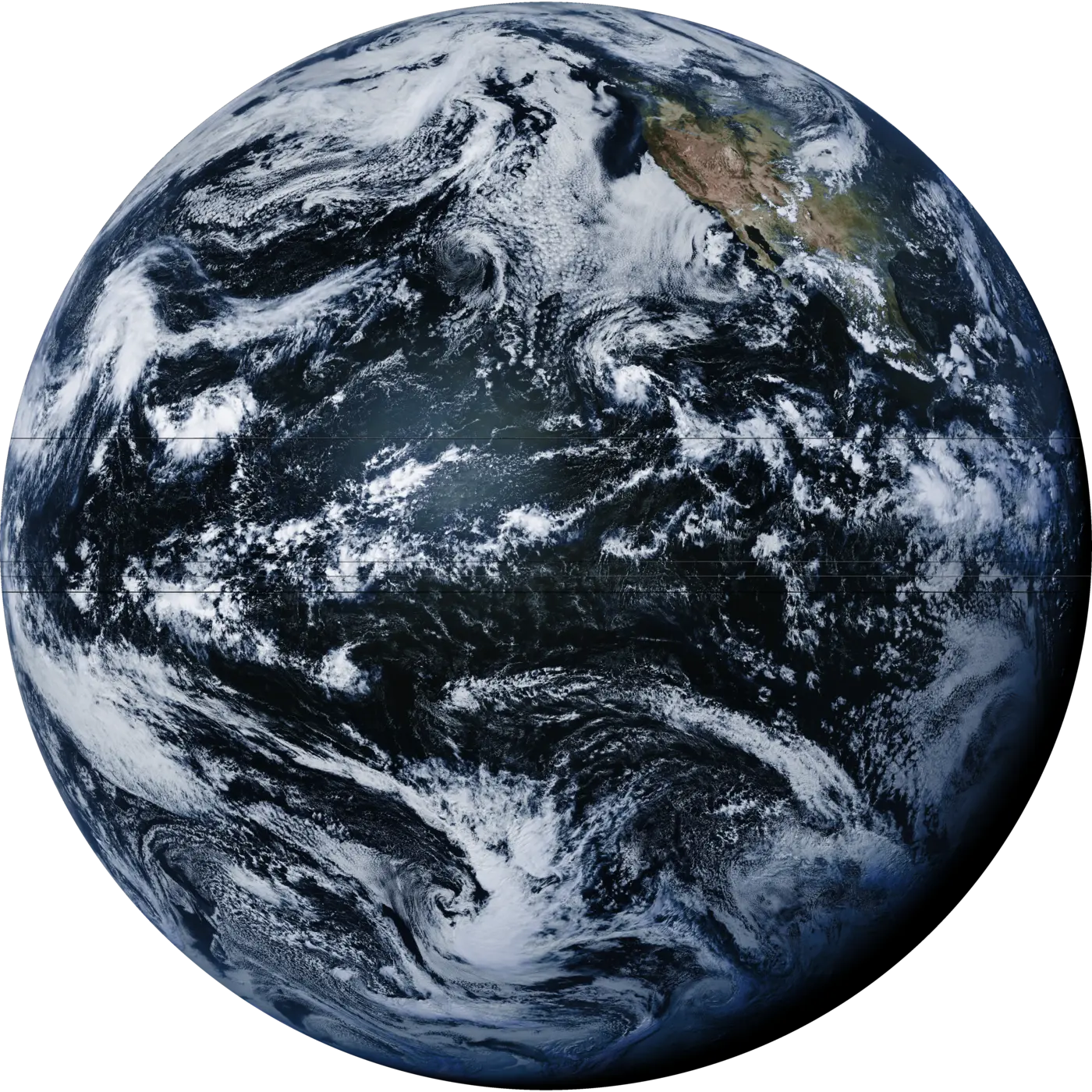
  • Received a live L-band downlink from GOES-18.
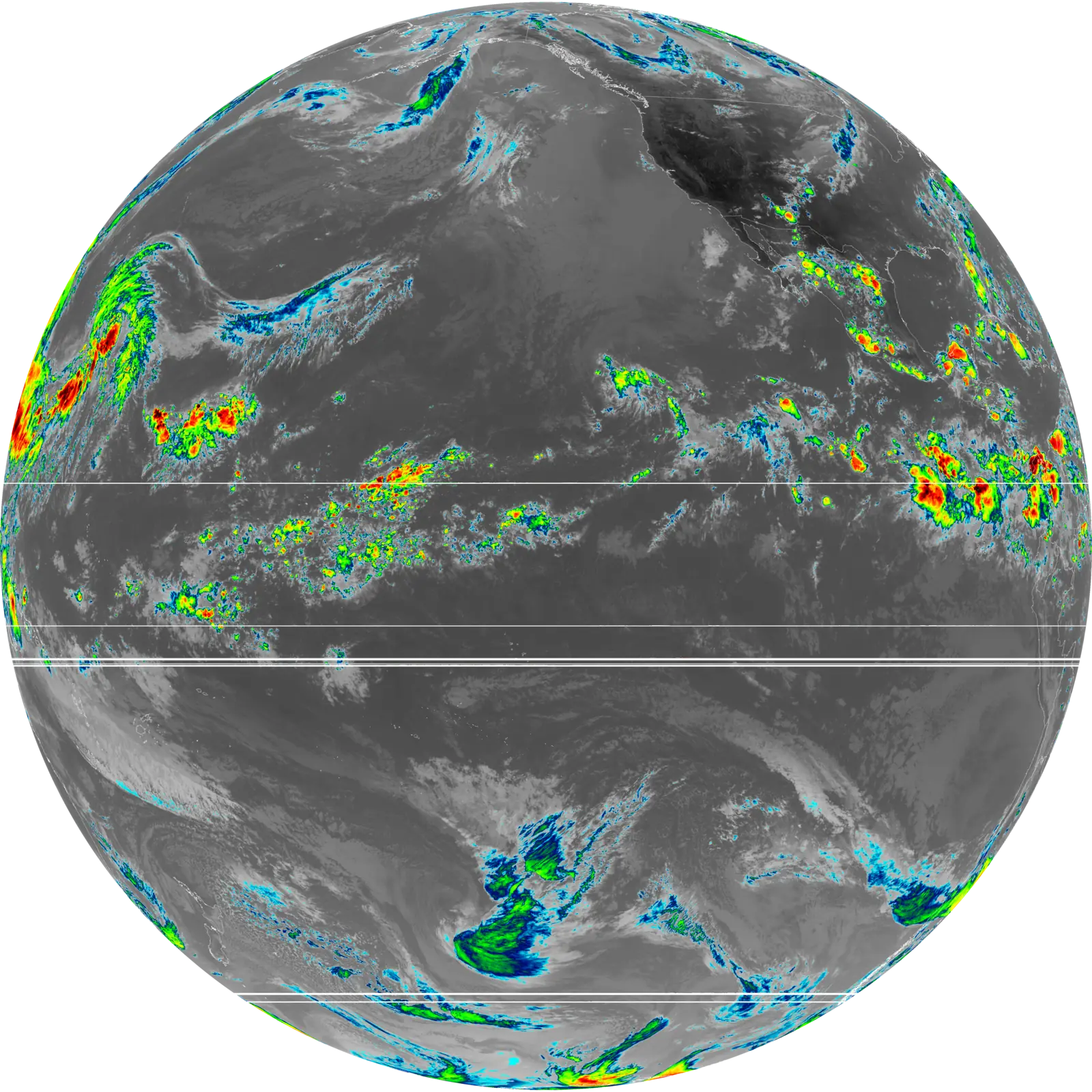
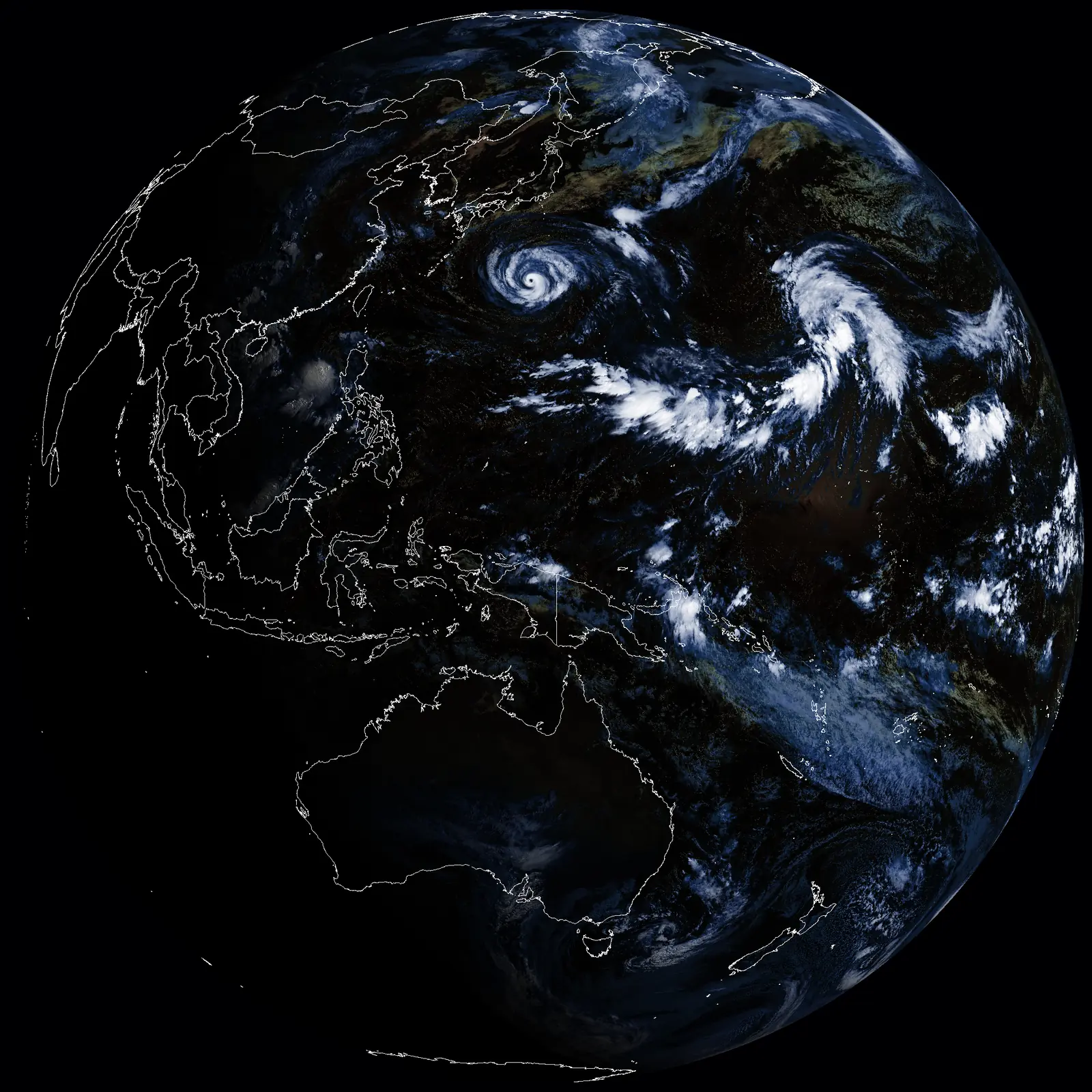
  • Processed infrared, water-vapour and false-colour imagery from GOES and Himawari-8.
  • Retuned the chain to 1420.4 MHz and detected the 21 cm hydrogen line from the Milky Way.
  • Now: building an S-band helical antenna. Next: a Meteor M2-3 polar-orbit station, and a galactic rotation curve from the hydrogen-line data.

Why the hydrogen line matters

It's one of radio astronomy's most important signals. Measuring its Doppler shift at different galactic longitudes gives a rotation curve. The gap between that curve and the visible mass is one of the classic pieces of evidence for dark matter.

Evidence
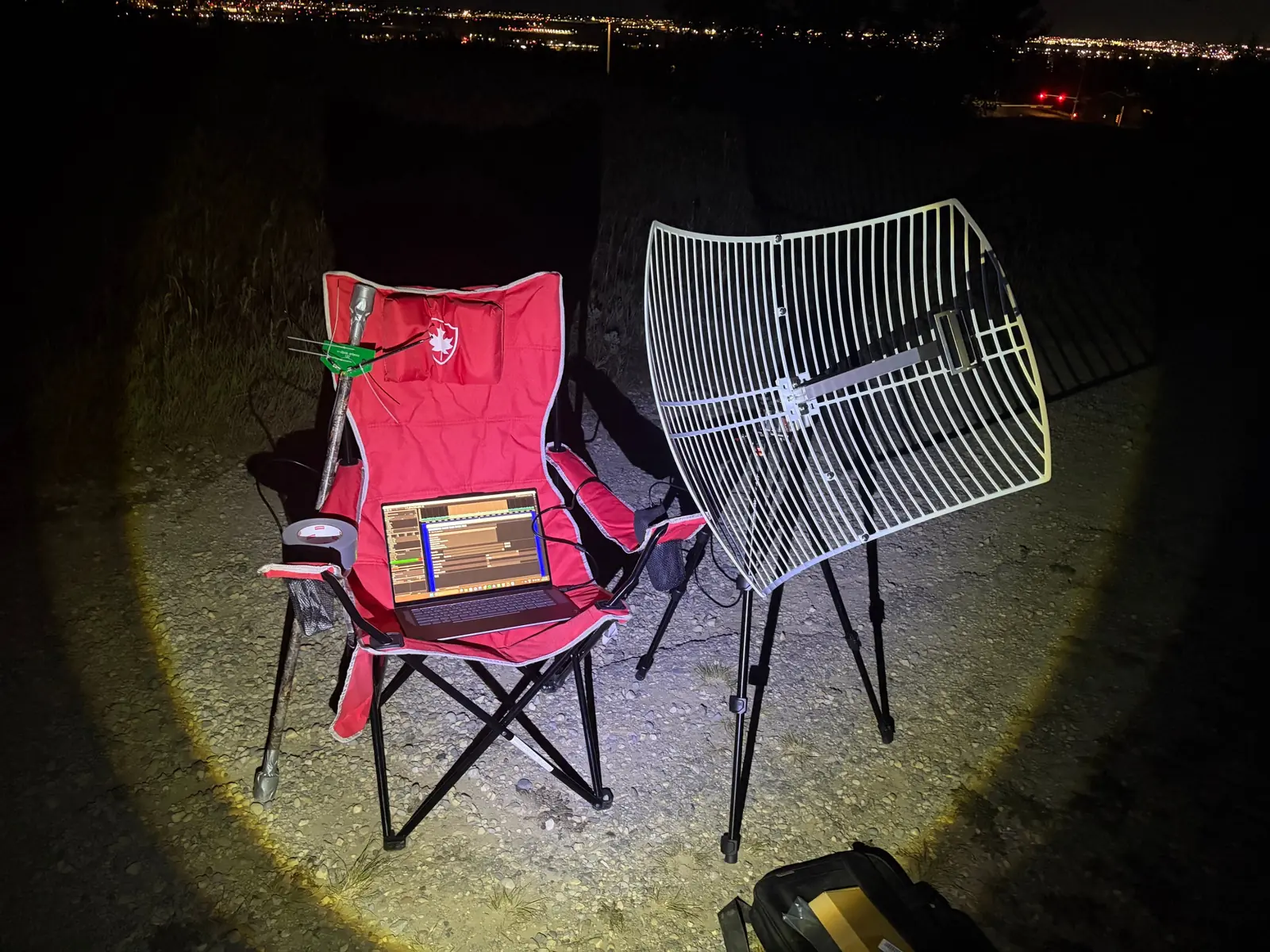
A grid parabolic dish on a tripod beside a red camping chair at night, with a laptop running SDR software on the seat and a small green PCB antenna taped to a pole. City lights glow in the distance.
The station in the field, set up away from city interference
Full-disk colour image of Earth centred on the Pacific, with North America at the upper right and cloud bands across both hemispheres.
GOES-18 full-disk image, received and decoded by the station
Infrared full-disk image of Earth in greys, with the coldest cloud tops coloured green through red along the tropics and in storm systems. A few thin horizontal streaks cross the disk.
GOES-18 infrared channel with an enhancement colour scale
Full-disk image centred on the western Pacific, with coastline outlines over East Asia and Australia and a typhoon spiral in the northwest Pacific.
Himawari full-disk image, relayed through the GOES-18 downlink
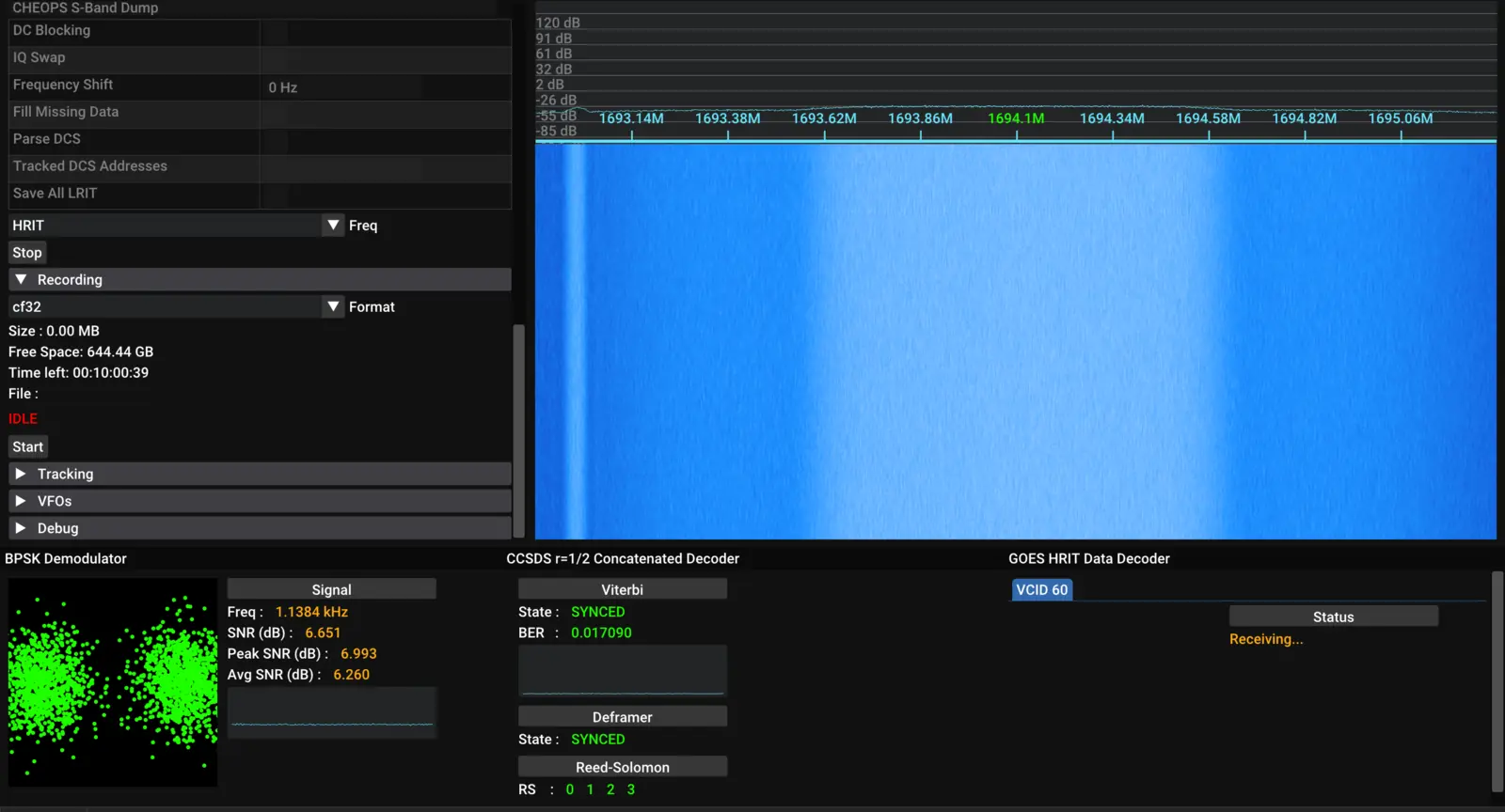
Screenshot of the SatDump GOES HRIT pipeline: a blue waterfall of the downlink, a BPSK constellation plot with two green clusters, and decoder status panels.
Live demodulation in SatDump: waterfall, BPSK constellation and decoder status

Post-run note

“Incredible! I now have images of Earth on my very own laptop. I wonder if I could build a stronger antenna…”